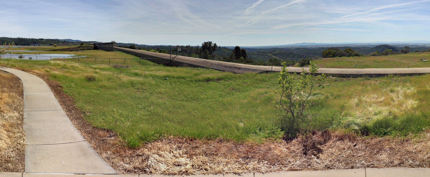
A view of the Oroville Dam emergency spillway from the Spillway boat launch in March 2016. In February 2017, much of the area was underwater as the emergency spillway was used for the first time in the dam’s 48-year history.
My thoughts are with everyone who has been affected by the crisis at Oroville Dam, which led to the evacuation of around 200,000 people living downstream Sunday out of fear of a collapse of the emergency spillway.
In less than a week, the 48-year-old structure has been faced with the double whammy of the deterioration of its primary concrete spillway and potentially devastating erosion of a concrete weir which doubles as an uncontrolled emergency spillway. It was the first problem that led to the second problem, culminating in Sunday’s emergency. (That said, the primary dam itself is OK, despite misleading news headlines to the contrary.)
I can’t fault Butte County Sheriff Kory Honea for his decision to call for the evacuation Sunday. I don’t have all the facts, but it sounded like things were on the verge of disaster and calling for residents to leave the area seems like a sensible precaution when lives are at stake. The region has had devasating floods in the past, which led to the construction of the dam complex in the first place (that and suppling water to downstate users).
While there should be some hard looks at the decisions that helped lead to this crisis, it’s unfortunate that a full Lake Oroville has turned into calamity. It’s the exact opposite of just three years ago when a half-full lake was used as the representation of California’s prolonged drought.
It wasn’t a pretty picture at the lake three years ago, which ironically made it a tempting image for photographers and TV news reports. At the drought’s low point (pun intended), all but one of the lake’s boat ramps were out of water and marinas had to remove houseboats because of the dwindling lake surface area. The lake looked like a giant, half-filled bathtub with the exposed shoreline looking like a red-colored ring.
I remember last spring, when a good water year helped fill the dam to near capacity. I stood on the trail overlooking the spillway as water flowed down it for the first time in years.
People I spoke with then were so elated to see the spillway open and the prospect of the lake filling to capacity (it didn’t in 2016, but it came close). I was personally awestruck when I calculated how much water was flowing down the channel, even though it looked so abstract at a distance.
That picture’s totally different today. The force of water took on a new, fear-raising aspect last week as we contemplated pictures and video of the concrete spillway being critically damaged.
As the lake reached new heights, concerns did too as the lake hit the emergency spillway level of 601 feet above sea level for the first time ever over the weekend.
Less than 36 hours after Oroville crossed that threshold, evacuation alarms were sounded as there were concerns that erosion could compromise the emergency spillway (I’m curious about when people started calling it an “auxiliary spillway,” because I’ve always seen it referred to the other way.)
Considering the damage that’s been done to the concrete spillway, I think it’s understandable that something catastrophic could happen to the emergency one. I don’t know how much water would be released in that situation — it wouldn’t be as much as a dam failure, but it would still be pretty bad. Even a two-foot elevation change could suddenly release about 10 billion gallons of water in the downstream Feather River.
As of last night, the state Department of Water Resources was working to lower the lake by about 50 feet. As the lake lowers about a foot every three hours, it will hopefully reach the 850-foot threshold before a new storm hits the area in a few days.
Still, I wonder if that’s enough. The DWR’s ability to remove water has been critically compromised by the problems with the two spillways. Even as the pressure on the emergency spillway is reduced with the lowering lake level, I don’t know if officials and the public should count on it until some serious inspections and repairs are made.
I think officials should keep lake water pressure off the emergency spillway structure AND maintain enough flood control buffer space (which one document I saw stated was 750,000 acre-feet, although I think that figure actually varies based on the time of year).
To accomplish both, I think the lake level should be lowered even futher — to about 788 feet above sea level. That’s based on the current drawdown to 850 feet, plus the 750,000 acre-feet of flood control buffer.
Such a move would leave the lake about 58.2 percent full (with 2.06 million acre-feet of water stored), at least until the end of the season when the flood control isn’t needed anymore.
It’s unfortunate that we should have to lower the lake level after years of wishing for a full lake. However, this recent storm showed the inadequacy of the current, impaired control system.
Lake Oroville has already seen two periods this year where water levels surged dramatically. If we want local residents to be safe in their homes in the event of a third surge, the lake level should be dropped to a threshold that offers the most safety without risking further damage to the emergency spillway.
