by Jack Lee
It was a cool windy day in May. Scattered gray clouds threated rain, but they never really did, a brief sprinkle at best. Down low in the canyon the air was almost still and sunshine occasionally filtered down on the blue oaks that dotted the landscape. This was how my trek began on the famous Yahi trail in Upper Bidwell Park going East and ending at the Bear Hole swiming area.
The trail was named for the Yahi Indians that once roamed freely between the great snow capped Mt. Lassen to the North and the Southern tip of what is now Butte County. In 1860 the last of the Yahi, a young boy named Ishi walked out of the forest and into civilization. He was warmly welcomed by the white settlers who took him in and introduced him to their way of life. He in turn taught them about the ways of his ancient Indian culture. Ishi’s family and tribe had been either killed in clashes with white settlers or died from new diseases carried by the settlers for which they had no immunity.
When you walk the Yahi trail you can’t help but think of those Indians like Ishi who walked there long before us. It was a sad end to a long story and now all that is left of the Yahi is found only in local museums or in this case, a few trails that are preserved for nature walks.
Actually, there are 3 trails, the upper, middle and lower. The upper trail leads along the
canyon rim and you can see for miles.
The middle trail is less challenging, but it offers more variety between panoramic vistas to a wide variety of plants and trees. The lower trail follows Butte creek and takes you past pools of crystal clear water lined with white alders, blue oaks, grey pines, wild grapes and green toyon.
Unlike the upper two trails, the lower trail is sheltered by a green canopy of leaves and vines that shade hikers for most of its length.
This is a great time of year to hike the Upper Bidwell Park (Chico, Ca). Everything is still green and the weather is generally cool and sunny. We have had some late rains this year, so that has kept the trail especially green and colorful with all manner of wildflowers. But, I have to caution those from outside this area, it’s not all beauty and wonder. You have to keep your eyes open for a number of things like poison oak, which can take many forms from brush along the trail to vines climbing the gray pines. There’s also the occasional rattle snake, but generally they will feel you coming down the trail
long before you can see them and they will retreat to a safe distance. And yes, there are critters here too, afterall this is their home and you are likely to see mule deer, fat raccoons and very rarely….a mountain lion (cougar).
I’ve never seen a cougar in all my years here, but I’ve seen their tracks and we’ve had a few unfortunate encounters with locals. But, mostly the mountain lions are just as happy to avoid you as you are to avoid them!
Last week I tracked a cougar near the Yahi trail for a short distance. His tracks were at times on top of a deer track, so it appeared the cougar was also tracking the deer. By the size of the track he appeared young, probably only about 100 pounds. The tracks were pretty fresh so I didn’t spend a lot of time trying to find the big cat for a photo op!
As you walk the Yahi you will notice the creek has exposed many layers of soil and lava, some of the lava is mud-like lava and that type originated from a prehistoric volcano near the town of Weaverville and then there are fractured lava and basalt cobbles. You can see a million years of geologic history exposed in high rocky cliffs on the south side of the creek and the oldest is right under your feet on the trail as it comes close to the creek’s edge.
Nearing the upper end of the Yahi trail the lava changes composition and it is seen as smooth dark brown rock cobbles, fractured on its surface into small squares, 5 to 6 inches on average (see photo below right).
Butte Creek is forced to wind its way through these lava cobbles and mounds that now look like boulders and find its way through their crevices to eventually emerge in a foaming rush of white water and small water falls. This feeds the large pools below and keeps the water pristine clear.
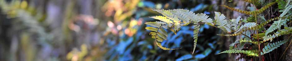
The following are some of the flora and fauna you’re likely to encounter on this trail: American pillwort and Toyon that grows near the vernal pools, wet cobbles, cliff faces and in shaded soil. Coffee fern grows among the bedrock outcrops and cliff faces. Bird’s foot ferns and even the rare Silver-backed fern is there among the fractured basalt too. Some of the conifers are Ponderosa pine and Gray pine. Flowering plants include Tumbleweed Ruderal, Poison oak and Vasey’s coyote thistle.
If you are a beginning hiker, I would suggest you plan on walking about half the Yahi
trail, then turn north and take a trail over to the improved road (gravel and hard pan) and return to the entrance. This will only take about an hour and you won’t feel too worn out. The overall distance takes between 1.5 and 3 hours depending on how many stops for photos you take. I took a leisurely trek with lots of stops and by the time I got back to my car at the parking lot near Horseshoe Lake I had walked for about 2.5 hours.
By the way, the sign at the entrance to the park really doesn’t say you have to be a on a leash. I just had some fun and reversed a couple of words with my picture editor. Oh, and one last thing, Bear Hole doesn’t mean you go swimming bare, but seems like every year dozens of young ladies new to Chico State College make that silly mistake. So, if you’re walking the trail in the warm days of summer, just be prepared to encounter a lot of nature!